

When Leipe lost its insularity 90 years ago
The route between Lübbenau and Leipe is one of the most beautiful cycling and hiking trails in the Spreewald. For around seven kilometers, the route crosses several high bridges through unspoiled nature. This path provided the first land connection to the island village of Leipe 90 years ago, and the village was connected to the road in 1969.
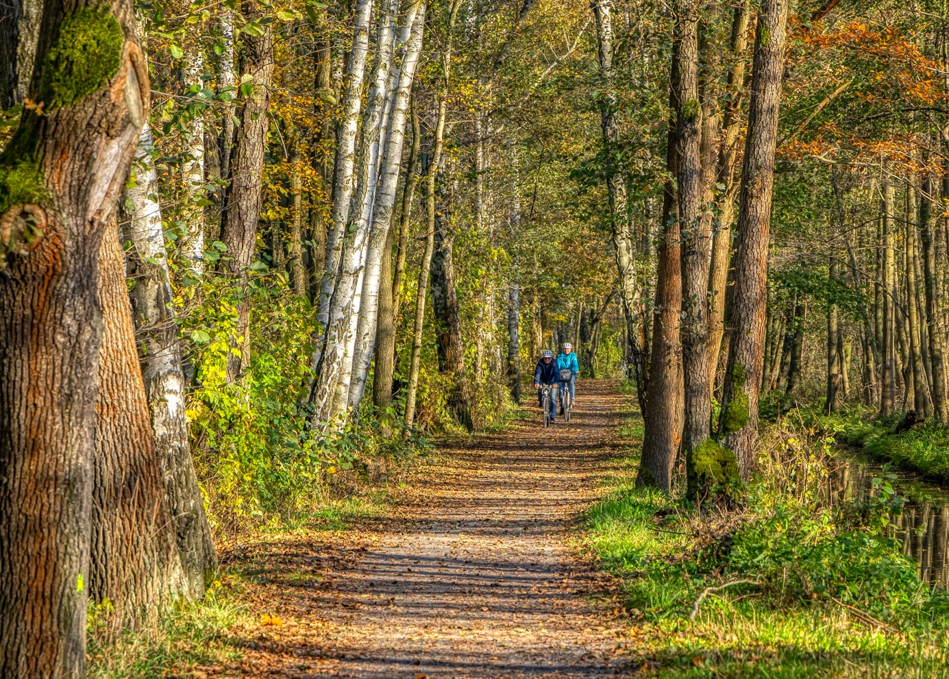
The path between Leipe and Lübbenau is one of the most beautiful cycle paths in the Spreewald.
Until the early 1930s, the village of Leipe, which had around 100 inhabitants, could only be reached by water. This may evoke certain romantic associations in outsiders, but in reality this life was characterized by numerous hardships. Leiper, who wanted or had to go into town (Lübbenau), needed almost a whole day to do so. Visits to the doctor in both directions were time-consuming and a lot of time passed before help arrived. Sometimes help came too late, especially in the pre-telephone era. Floods, ice drifts or unsustainable ice were particularly bad – a land connection became the order of the day!
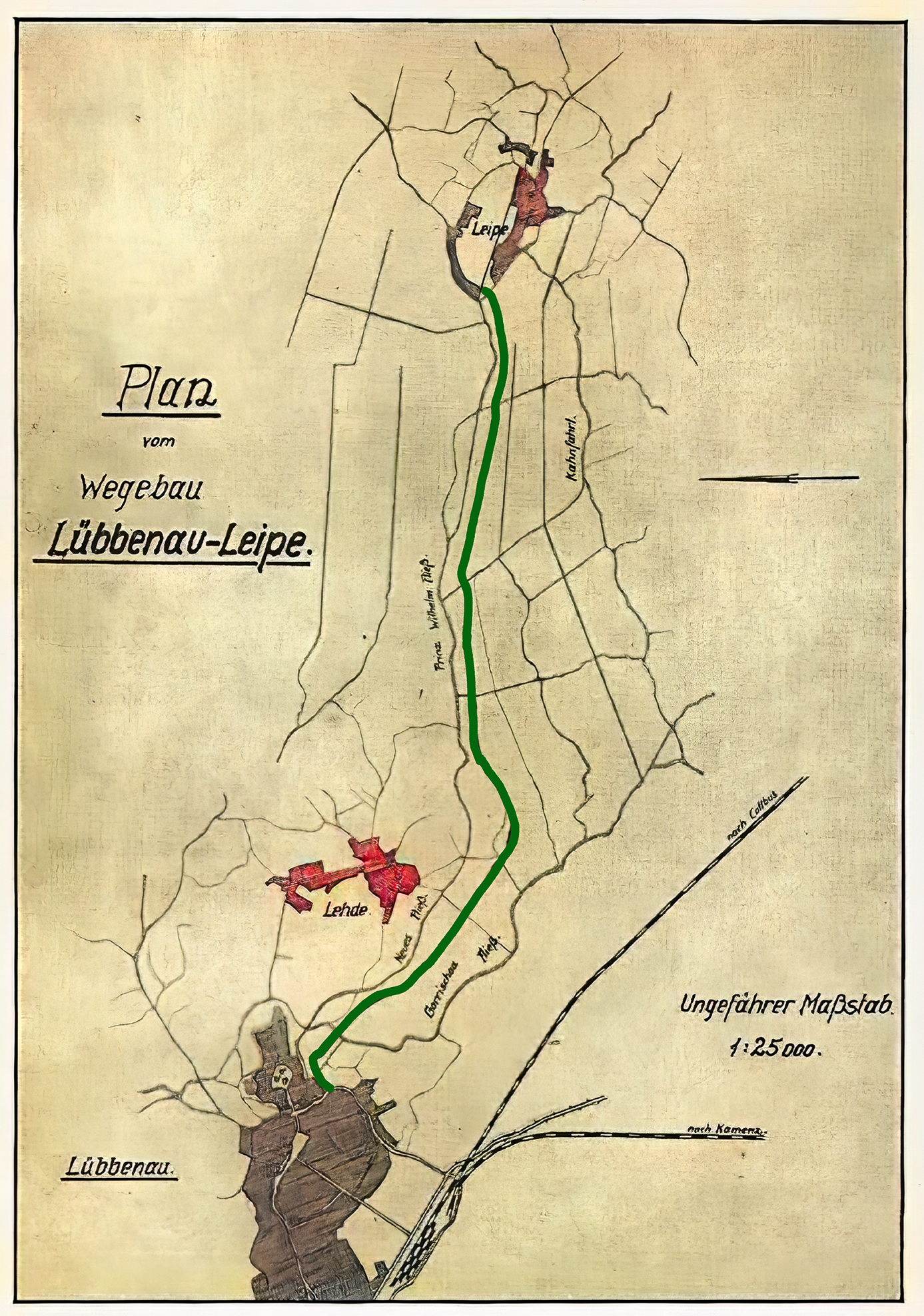
The people of Leip, who have felt part of Lübbenau for many decades and were incorporated in 2003, would never have been able to make this almost seven-kilometer-long path along the Spree through inhospitable terrain, swamps and undergrowth on their own. The town fathers of Lübbenau, above all Mayor Kirsch, seized the opportunity with the creation of the Nazi labor services in 1933 and applied for the construction of a road to Leipe, as well as for the construction of a dam in the direction of Lübben. This was granted and the first work began in 1933. The labor service was military, young men were quartered in barracks near the port. Their weapon was the spade, which they had to shoulder like a rifle when marching out to work (often accompanied by singing).
Construction of the path began with the ground-breaking ceremony on May 26, 1933, starting from Lübbenau by throwing up soil from both sides. The result was a dam with two accompanying ditches. It was filled with 4500 m³ of sand, which was brought in on barges via the parallel ditches. These trenches had to be sealed off by cross dams as construction progressed, and the residual water was drawn off by motor pumps. The onset of winter put an end to the construction work just a few hundred meters from Leipe. In the spring of 1934, the path was essentially completed, with the remaining work continuing until 1936. Ten bridges had to be built for the path – a huge increase in orders for Lübbenau carpenters.
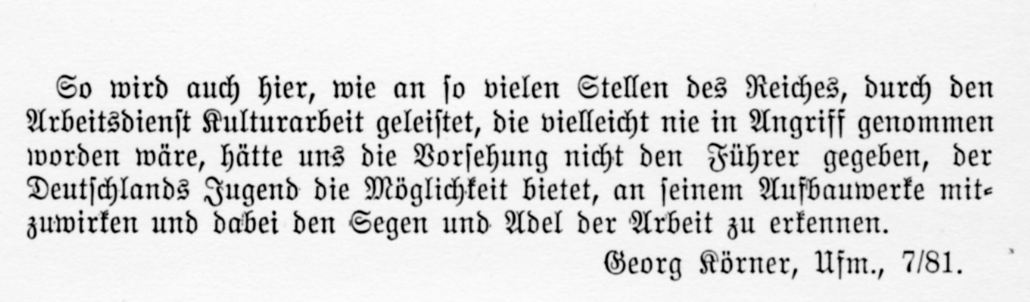
Ideologically tinged article – very thought-provoking – in a brochure about the Spreewald published in 1935.
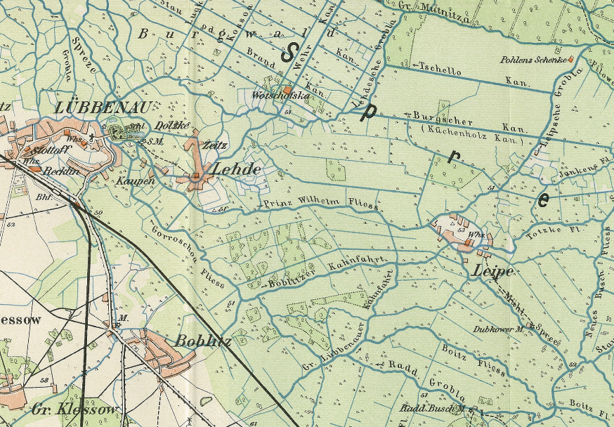
The map section from 1910 shows the island location of Leipe – no overland route leads to the village.
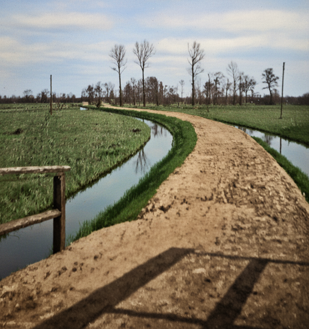
The path shortly after its completion in 1934, the not yet so lush tree cover is striking – as it appears today.*
This meant that Leipe could be reached via a narrow land connection for the first time and a major worry fell from the shoulders of the inhabitants, the road gave them the certainty that help could be provided quickly in an emergency. Now they could be in town by bike in just over half an hour to do their shopping or visit the doctor. Later, in 1964, a drinking water pipeline for Leipe was also built along the path. This meant that the company’s own fountains were no longer needed.
For years, the then still very narrow path was also used by motorcyclists, which repeatedly led to accidents. Former Leiper Hubert Jedro was hit and injured by a motorcyclist on his way home from school in Lübbenau when he was unable to use the school barge that day. This ran between Leipe and Lübbenau until 1969. In the same year, the road towards Burg was completed, giving Leipe access to the neighboring communities in an easterly direction. Hubert Jedro: “We didn’t like it at all: from the cozy school boat to the rickety school bus, from the city school to a village school – we had to get used to it.”
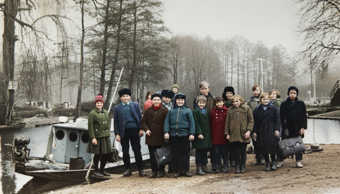
School barge before departure in Lübbenau 1968*
The road between Lübbenau and Leipe was upgraded in the 2020s, and the bridges in particular were renewed so that two-lane vehicles can also use them in an emergency.
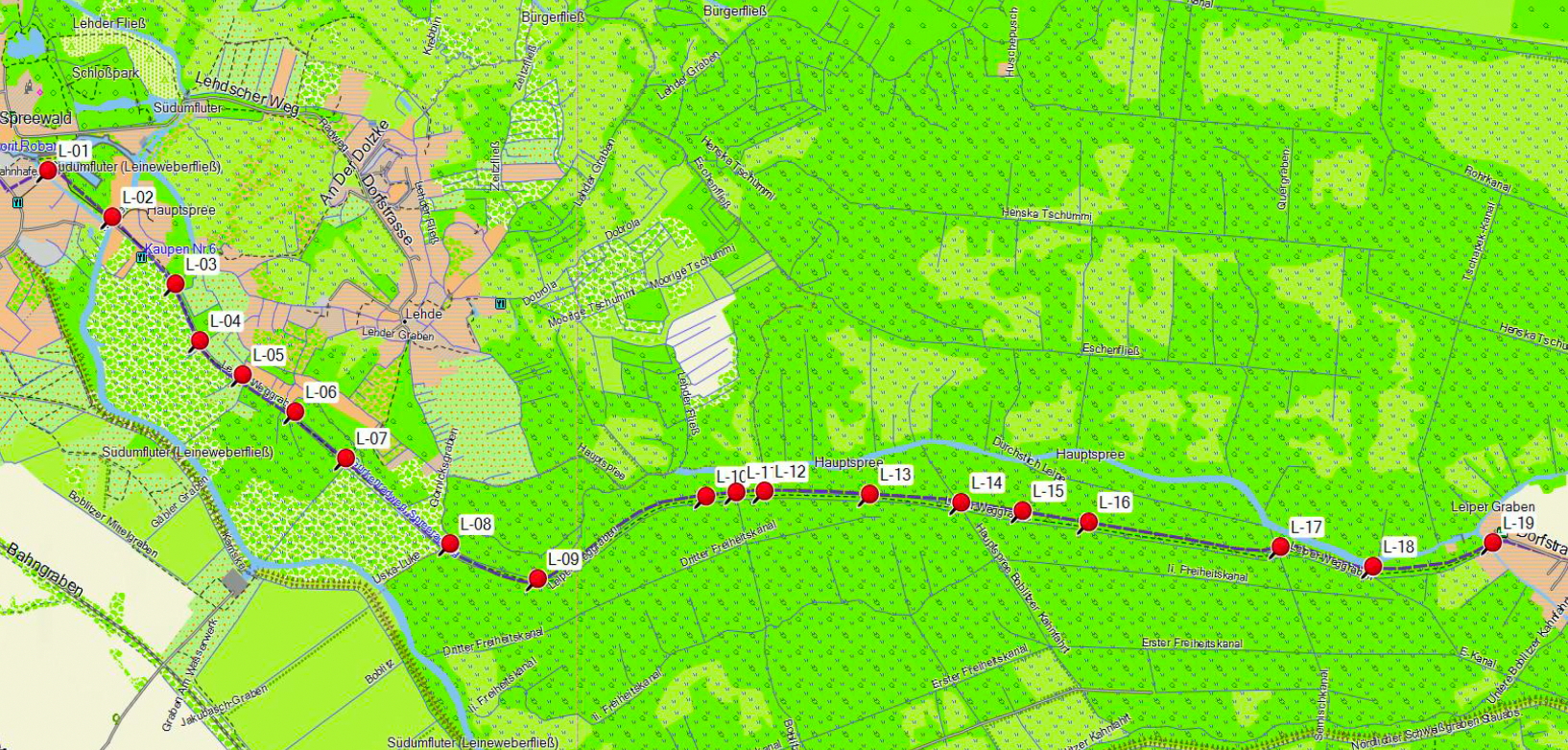
The path had already been marked with rescue points at regular intervals in 2012. Henning Müller was commissioned by the DRK district association at the time. “The sharp increase in route usage also led to an increase in emergencies, from heart attacks to broken bones. I remember an emergency on July 5, 2012, where the patient couldn’t describe where he was – everything looked the same to him. Coming from Lübbenau, the ambulance struggled along the narrow lane through the numerous hikers and cyclists and found the seriously ill man about 100 meters before the entrance to the village of Leip. It was now overdue to put up these markings, there were 19 in total at the time, but they have since been reduced somewhat,” recalls Henning Müller, who was in charge of the work at the time in cooperation with the town of Lübbenau.
Peter Becker, 03.02.2026
Sources and thanks: Photos and documents come from the collections of Hans-Joachim Nemitz, Henning Müller, Lübbenau and Dietrich Dommain, Lübben. More precise sources are often no longer available.
*Historical recordings; were restored with AI.

